Biochar Map for Gotland
Within the LEADER Gute Project “E-kol-ogiskt! – a demonstration project for the application of biochar on Gotland”, Waila AB is examining the utilization potential for biochar on the Swedish island of Gotland.
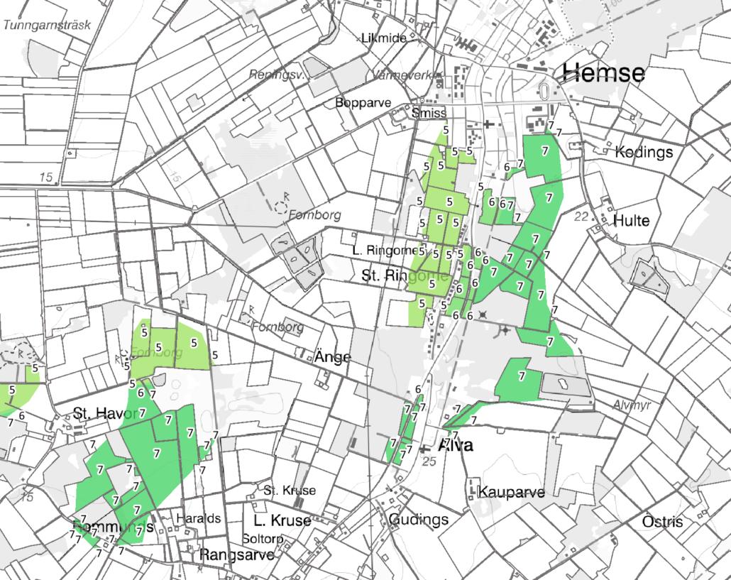
In a sub-project, the total arable land area of Gotland has been examined with help of a GIS analysis. For this purpose, data from Swedish national authorities, such as the Swedish Meteorological and Hydrological Institute, the Swedish Board of Agriculture and the Swedish Agency for Marine and Water Management were combined. The resulting biochar map highlights those arable areas which will be most affected by draught conditions in the near future and should profit the most from an increase in the nitrogen fertilizing efficiency – last but not least to reduce nitrogen emissions to the atmosphere, ground water and the sea. These areas are most appropriate for biochar application, since both the water storage capacity and the nitrogen storage capacity of the soil can be improved with biochar.
With the help of the biochar map for Gotland it is now possible to identify the biochar application potential of every single arable land plot on Gotland. The maps includes a detailed description of the applied analysis method.
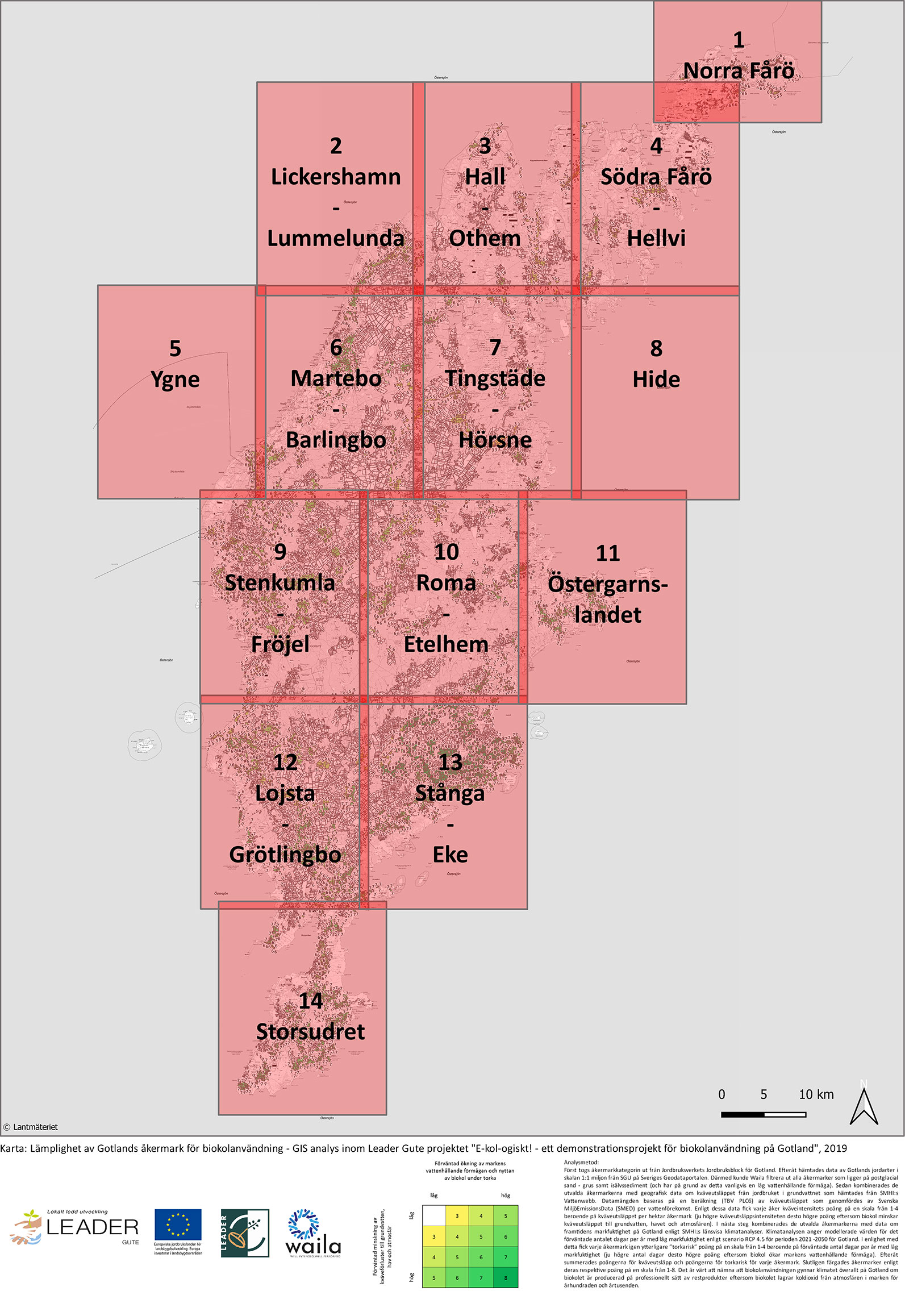
Click here to see an overview map for the whole island of Gotland.

